 EMODnet Product Catalogue
Portuguese Geographical Institute
Type of resources
Available actions
Topics
Keywords
Contact for the resource
Provided by
Years
Formats
Representation types
Scale 1:
Resolution
-
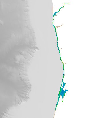
Digital Terrain model of the coastal areas of mainland Portugal obtained from a survey with LiDAR technology during the year 2011. This information can be found in the reference system PT-TM06 (ETRS89) .This project is a partnership between the General Directorate of Territory (DGT) and the Portuguese Environment Agency (APA), within the scope of the National Strategic Reference Framework.
-
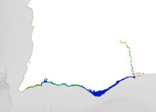
Digital Terrain model of the coastal areas of mainland Portugal obtained from a survey with LiDAR technology during the year 2011. This information can be found in the reference system PT-TM06 (ETRS89) .This project is a partnership between the General Directorate of Territory (DGT) and the Portuguese Environment Agency (APA), within the scope of the National Strategic Reference Framework.
-
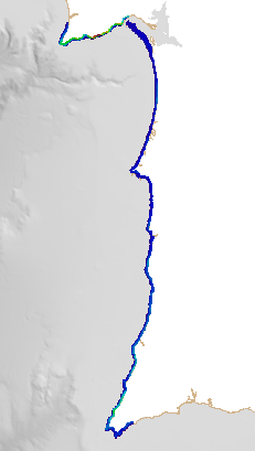
Digital Terrain model of the coastal areas of mainland Portugal obtained from a survey with LiDAR technology during the year 2011. This information can be found in the reference system PT-TM06 (ETRS89) .This project is a partnership between the General Directorate of Territory (DGT) and the Portuguese Environment Agency (APA), within the scope of the National Strategic Reference Framework.
-
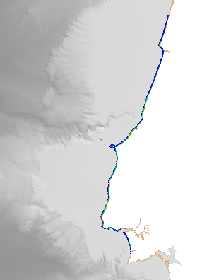
Digital Terrain model of the coastal areas of mainland Portugal obtained from a survey with LiDAR technology during the year 2011. This information can be found in the reference system PT-TM06 (ETRS89) .This project is a partnership between the General Directorate of Territory (DGT) and the Portuguese Environment Agency (APA), within the scope of the National Strategic Reference Framework.